Me to you
I was planning a trip, and mindlessly scanning google maps satellite view. Inspired, I captured satellite images of the entire path from my house to my friends, and printed it out on a strip of paper 1″ wide by 36″ long. I rolled up the strip, put it in a tube, and mailed to my friend. The post office lost it, so I made like 8 more and sent to other people. I ulitmately would like to build a little motorized reader, that would slowly spin the paper strip showing the actual path a bird would take. Whatever. The samples below don’t really do justice to the physical strip in your hand. Let me know and I’ll send you one.
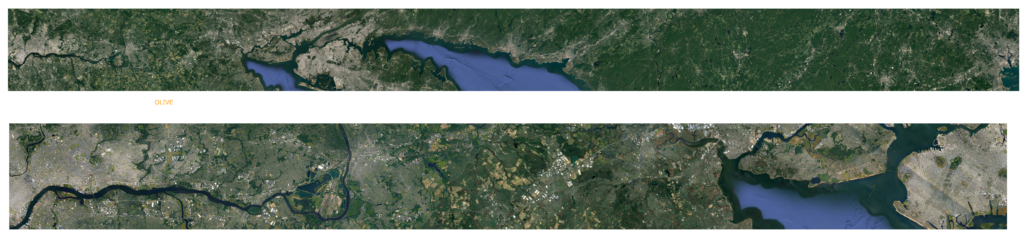
Here are two example, Philadelphia (me) on the left, my two children on the right. Top is Boston, bottom is Brooklyn. Check out the Delaware River valley!
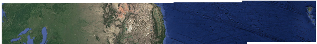
And here is one to my friend in Hawaii. Again, Philadelphia on the left, Honolulu on the right. Disorienting as hell.
Update, the post office says they can not find my tube!